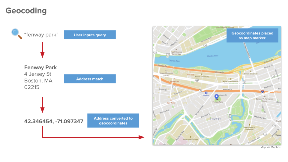
What is Geocoding?
Geocoding (also known as forward geocoding to distinguish it from reverse geocoding) is that it is the process of converting addresses (e.g. a house number, street name, zip code), into geographic coordinates (latitude and longitude).
The simplest example of geocoding is in consumer map applications like Google Maps and Apple Maps, converting a location's coordinates, address, or place name to a physical location (ie. into spatial data), which is then displayed on a map. 
How Does Geocoding Work?
Geocoding is a computational process of converting disparate types of geographic data into another form, for example, a human-readable name and an alphanumeric string.
Geocoding uses absolute input data. Examples of absolute input data include the name of a location or a zip code. This is in contrast to relative input data, which cannot be used to identify a place, like "the building opposite the Stock Exchange.”
Geocoding algorithms use interpolation to figure out a location based on input parameters; the more information the algorithm has to work with, the more accurately it can pinpoint a place.
For example, La Sagrada Familia church can be located on Google Maps by entering its latitude and longitude (41.403875,2.174261), address (Carrer de Mallorca, 401, 08013 Barcelona, Spain) or name (La Sagrada Familia). Try it out here. You will see that searching for “Sagrada Familia” returns a number of possible locations; you have to narrow (interpolate) your search to find the most relevant place you are looking for.
Geocoding vs. Reverse Geocoding
Reverse geocoding (sometimes called backward geocoding) transforms geographic coordinates to a readable location description, usually either a place name or address.
Simply, geocoding is used to get the coordinates of a place, and reverse geocoding uses coordinates to find a place.
Use Cases for Geocoding
- Finding the Exact Spot: Businesses need to accurately locate their stores or offices in order to provide the correct directions to customers and suppliers. Health and safety organizations, in particular, rely on accurate geolocation when they respond to a call.
- Accurate Taxation: Businesses rely on accurate geocoding because taxes and insurance are calculated according to exact locations, in accordance with precise actuarial tables.
- Marketing Analytics (Geomarketing): Organizations use geocoding to visually identify spatial patterns in customers’ spending habits. Geocoding is also used to map customers’ locations, target products towards customers within specific demographics and plan delivery routes.
- Research: Researchers may use batch geocoding to monitor the spread of disease in a region, or calculate the risk of fires or flooding in an area. Law enforcement may use geocoding to analyze crime in certain areas.
